Explore places with Nithesh Tours And Travels
Places in Kerala
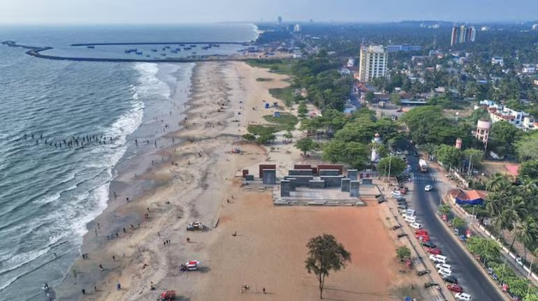
Kochi
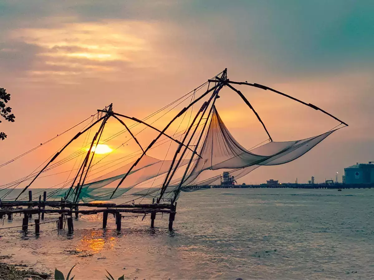
Kochi also known by its former name Cochin is a major port city along the Malabar Coast of India bordering the Laccadive Sea. It is part of the district of Ernakulam in the state of Kerala. The city is also commonly referred to as Ernakulam. As of 2011, the Kochi Municipal Corporation had a population of 677,381 over an area of 94.88 km2, and the larger Kochi urban agglomeration had over 2.1 million inhabitants within an area of 440 km2, making it the largest and the most populous metropolitan area in Kerala. Kochi city is also part of the Greater Cochin development region and is classified as a Tier-II city by the Government of India. The civic body that governs the city is the Kochi Municipal Corporation, which was constituted in the year 1967, and the statutory bodies that oversee its development are the Greater Cochin Development Authority (GCDA) and the Goshree Islands Development Authority (GIDA).
Wayanad
Wayanad is a district in the north-east of the Indian state of Kerala, with administrative headquarters at the municipality of Kalpetta. It is the only plateau in Kerala. The Wayanad Plateau forms a continuation of the Mysore Plateau, the southern portion of the Deccan Plateau. It is set high in the Western Ghats with altitudes ranging from 700 to 2,100 meters. Vellari Mala, a 2,240 m (7,349 ft) high peak situated on the trijunction of Wayanad, Malappuram, and Kozhikode districts, is the highest point in Wayanad district. The district was formed on 1 November 1980 as the 12th district in Kerala, by carving out areas from Kozhikode and Kannur districts. An area of 885.92 km2 in the district is forested. Wayanad has three municipal towns—Kalpetta, Mananthavady and Sulthan Bathery. There are many indigenous tribes in this area. The Kabini River, a tributary of the Kaveri River, originates at Wayanad. Wayanad district, along with the Chaliyar valley in the neighbouring Nilambur (Eastern Eranad region) in Malappuram district, is known for natural gold fields, which are also seen in other parts of the Nilgiri Biosphere Reserve. The Chaliyar river, which is the fourth longest river of Kerala, originates on the Wayanad plateau. The historically important Edakkal Caves are located in Wayanad district.
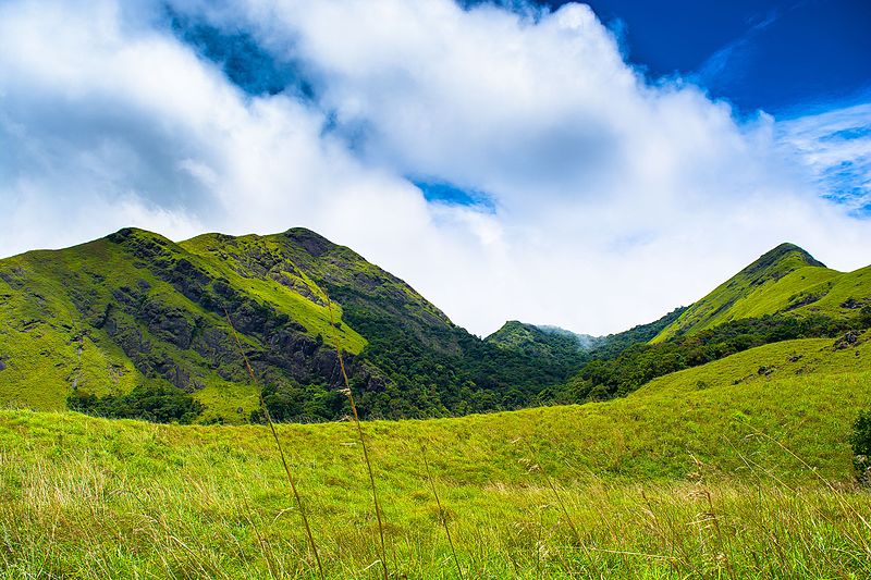
Munnar
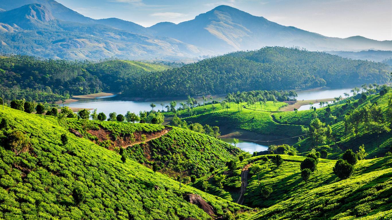
Munnar is a town and hill station located in the Idukki district of the southwestern Indian state of Kerala. Munnar is situated at around 1,600 metres (5,200 ft) above mean sea level, in the Western Ghats mountain range. Munnar is also called the "Kashmir of South India" and is a popular honeymoon destination.
Alappuzha
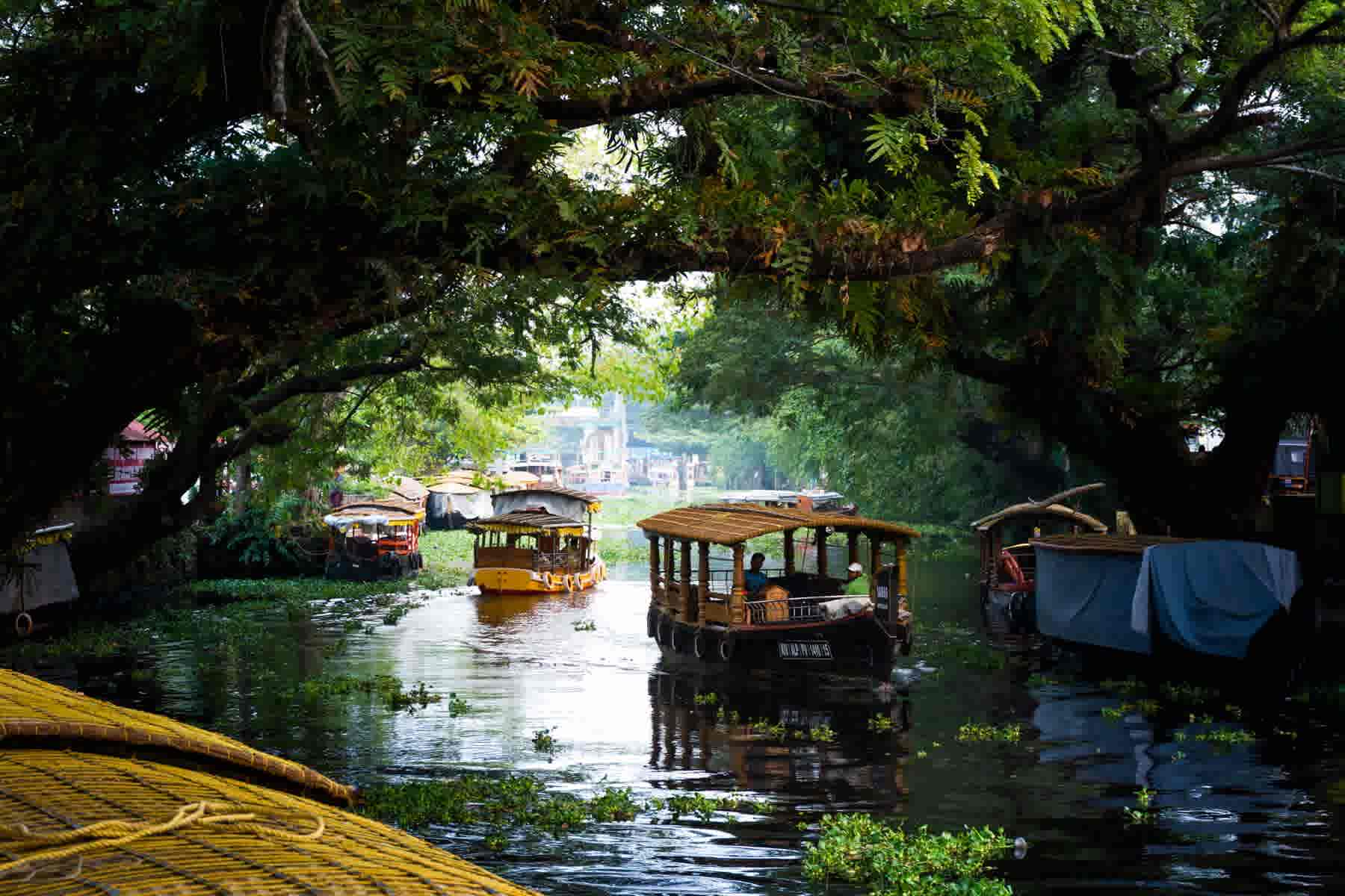
Alappuzha, also known as Alleppey, is a municipality in the Alappuzha district of Kerala, India. It is the district headquarters of the district, and is located about 130 km (80.8 mi) north of the state capital Thiruvananthapuram. As per the 2011 Indian census, Alappuzha has a population of 240,991 people, and a population density of 3,675/km2 (9,520/sq mi).
Kozhikode
Kozhikode, official name until 1990 was Calicut, is a city along the Malabar Coast in the state of Kerala in India. Known as the City of Spices, Kozhikode is listed among the UNESCO's Cities of Literature. It has a corporation limit population of 609,224 and a metropolitan population of more than 2 million, making it the second most populous metropolitan area in Kerala and the 19th largest in India. Kozhikode is classified as a Tier 2 city by the Government of India.
Thekkady
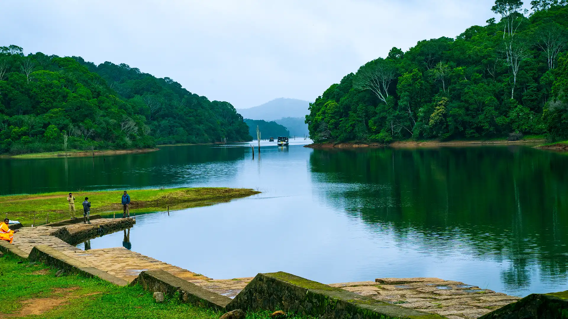
Thekkady is a town near Periyar National Park, an important tourist attraction in the Kerala state of India. The name Thekkady is derived from the word "thekku" which means teak. Temperatures are lowest in the months of December-January and highest in the months of April-May.
Thrissur
Thrissur formerly Trichur, also known by its historical name Thrissivaperur, is a city and the headquarters of the Thrissur district in Kerala, India. It is the third largest urban agglomeration in Kerala after Kochi and Kozhikode, and the 21st largest in India. The city is built around a 65-acre (26 ha) hillock called Thekkinkadu Maidanam which seats the Vadakkunnathan temple. It is located 304 kilometres (189 mi) north-west of the state's capital city, Thiruvananthapuram. Thrissur was once the capital of the Kingdom of Cochin, and was a point of contact for the Assyrians, Greeks, Persians, Arabs, Romans, Portuguese, Dutch and English.
Thiruvananthapuram
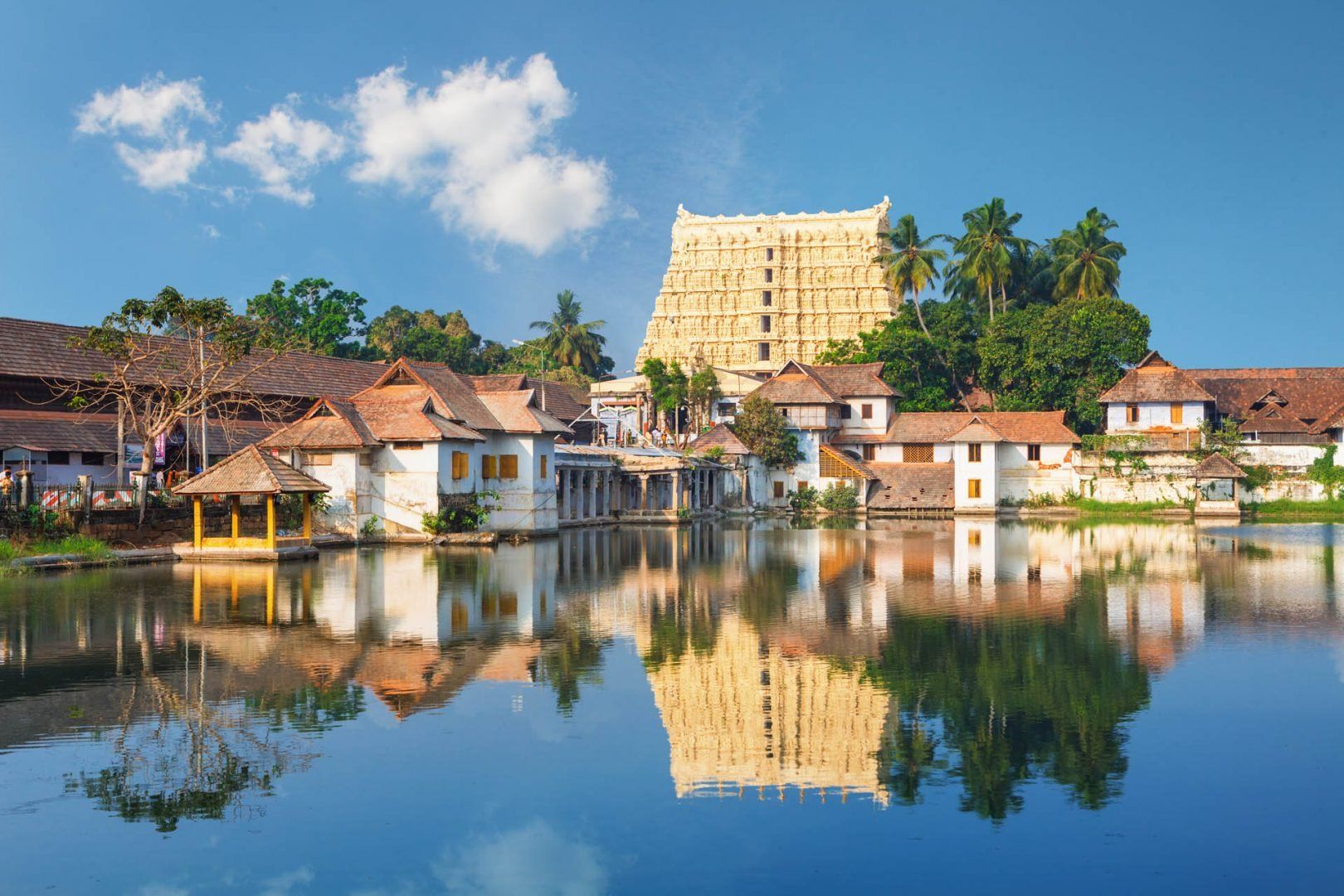
Thiruvananthapuram formerly known as Trivandrum, is the capital city of the Indian state of Kerala. It is the most populous city in Kerala with a population of 2,984,154 as of 2024. The encompassing urban agglomeration population is around 1.68 million. Located on the west coast of India near the extreme south of the mainland, Thiruvananthapuram is a major information technology hub in Kerala and contributes 55% of the state's software exports as of 2016. Referred to by Mahatma Gandhi as the "Evergreen city of India", the city is characterised by its undulating terrain of low coastal hills.
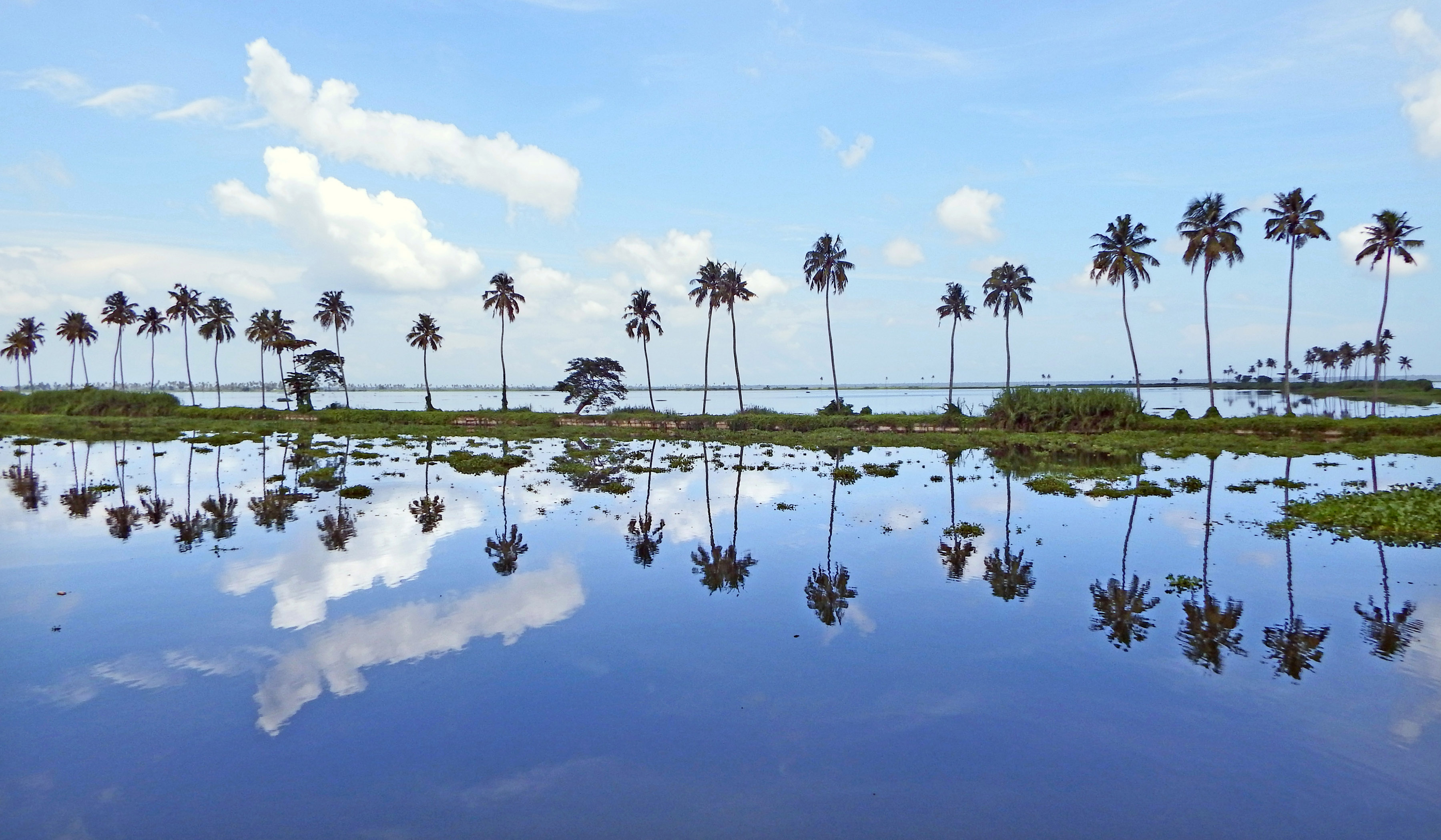
Marari Beach
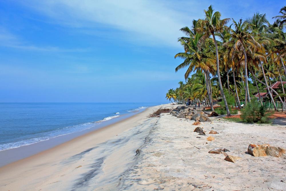
Mararikulam is connected by rail and has a railway station by the same name. It is also well connected by road. NH 66 passes through S.L.Puram, which is 5 km to the east of Mararikulam. Nearest airport is Cochin International Airport. It was rated as one of the worlds top five HAMMOCK BEACH by National Geographic survey.[citation needed] & The CGH Marari beach resorts has made it to the "Sense of Place" final list of National Geographic Traveller "WORLD LEGACY AWARD" by National Geographic in partnership with ITB Berlin
Bekal fort
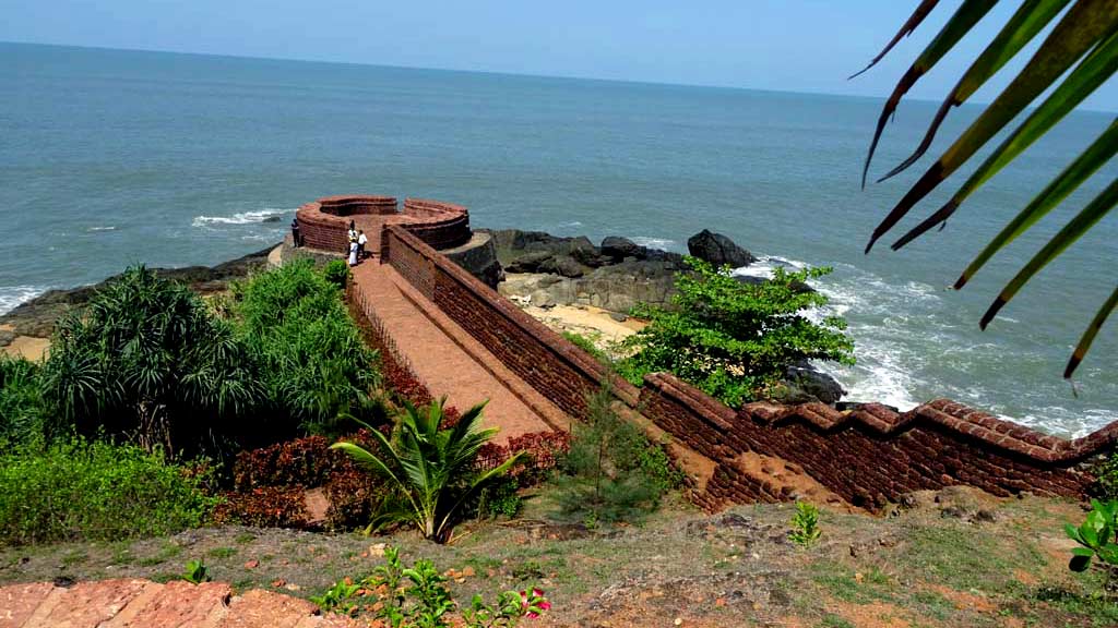
The fort appears to emerge from the sea. Almost three-quarters of its exterior is in contact with water. Bekal fort was not an administrative centre and does not include any palaces or mansions. An important feature is the water-tank, magazine and the flight of steps leading to an observation tower built by Tipu Sultan.Standing at the centre of the fort, this offers views of the coastline and the towns of Kanhangad, Pallikkara, Bekal, Mavval, Kottikkulam, and Uduma.
Kannur
Kannur formerly known in English as Cannanore, is a city and a municipal corporation in the state of Kerala, India. It is the administrative headquarters of the Kannur district and situated 274 kilometres (170 mi) north of the major port city and commercial hub Kochi and 137 kilometres (85 mi) south of the major port city and a commercial hub, Mangalore. During the period of British colonial rule in India, when Kannur was a part of the Malabar District (Madras Presidency), the city was known as Cannanore. Kannur is the fifth largest urban agglomeration in Kerala. As of 2011 census, Kannur Municipal Corporation, the local body which administers mainland area of city, had a population of 232,486.
Guruvayur
Guruvayur is a municipal temple town in Thrissur district, of Kerala State in India. It is a suburban town of Thrissur city, located 27 kilometres (17 mi) from Thrissur towards the north-west. It houses the Guruvayur Shri Krishna Temple. It is located at a distance of 292 km (181 mi) from the state capital Trivandrum towards the north-west, 80 km (50 mi) from Kochi towards the north, 90 km (56 mi) from Calicut towards south.
Sabarimalai
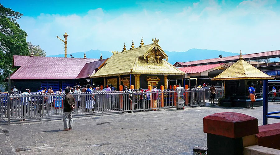
The Sabarimala Sree Dharma Sastha Temple is a Hindu temple dedicated to the god Ayyappan, who is also known as Dharma Shasta and is the son of the deities Shiva and Mohini (female avatar of the god Vishnu).The temple is situated atop the Sabarimala hill in the village of Ranni-Perunad, within the Ranni Taluk of the Pathanamthitta district in the state of Kerala, India. The temple is surrounded by 18 hills in the Periyar Tiger Reserve. It is one of the largest annual pilgrimage sites in the world, with an estimate of over 10 to 15 million devotees visiting every year.
Kottayam
Kottayam is a city in the Kottayam district of Kerala, India. It is the district headquarters of the district and is located about 151 km (93.8 mi) north of the state capital Thiruvananthapuram. As per the 2011 Indian census, Kottayam has a population of 489,615 people, and a population density of 4,533/km2 (11,740/sq mi). The total Kottayam Metropolitan area (the combined area of Kottayam municipality and its adjacent suburbs) has a population of 802,419 people, and a population density of 3,647/km2 (9,450/sq mi).