Explore places with Nithesh Tours And Travels
Places in Chikmagalur
Siri Cafe
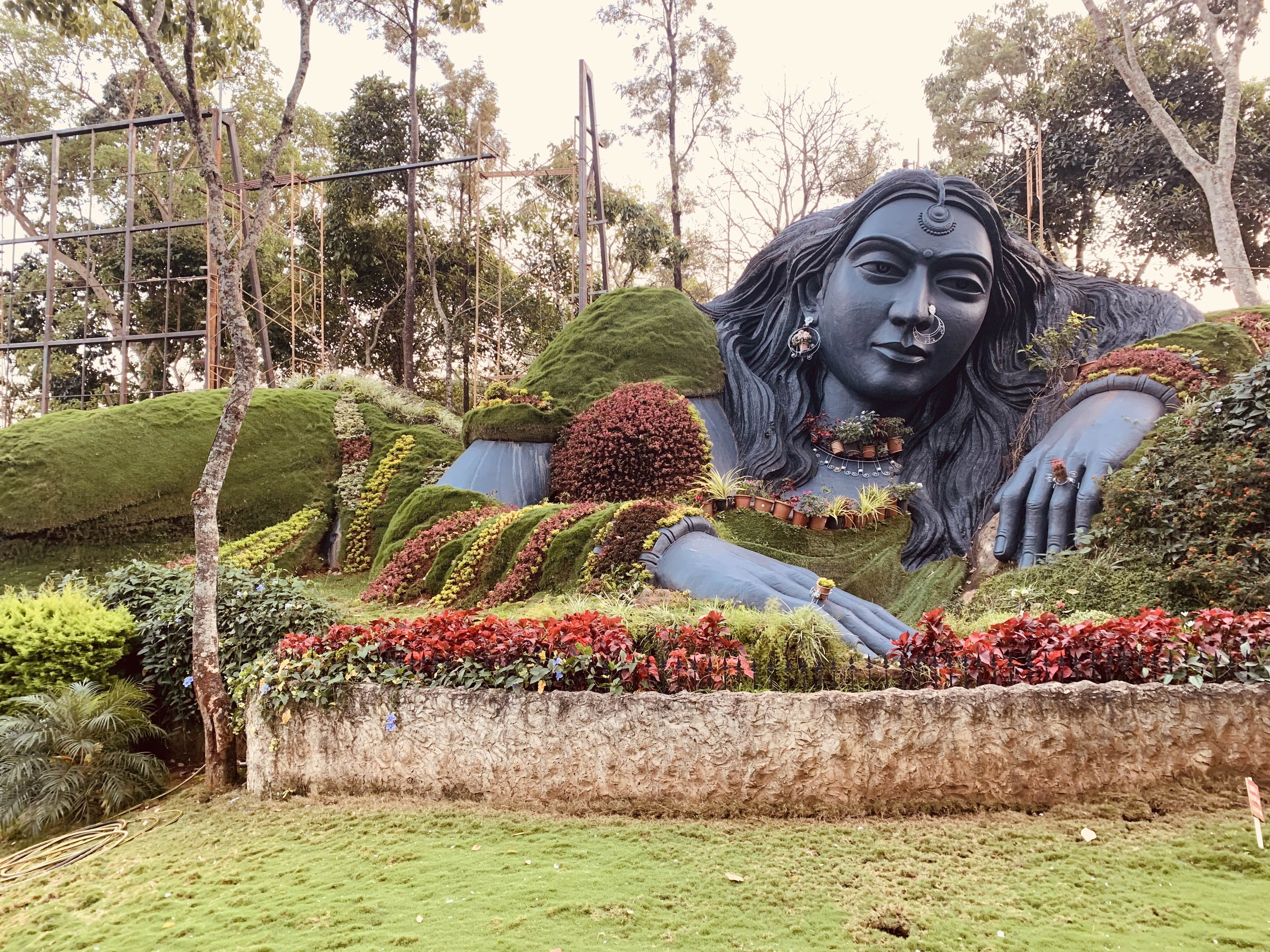
When nature is depicted as a beautiful girl, grass becomes her garment, the colorful flowers become the border of her dress and the flower pots become her perfect necklace. The gigantic sculpture of the girl is found at the entrance of Siri Cafe, a restaurant located on the way from Chikmagalur to Mullayanagiri. It definitely catches everyone's eyes. Regardless of whether you are hungry/thirsty or not, you would decide to stop by and get into this restaurant just by seeing this attractive sculpture.
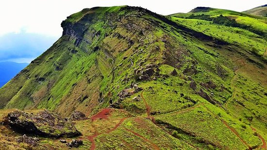
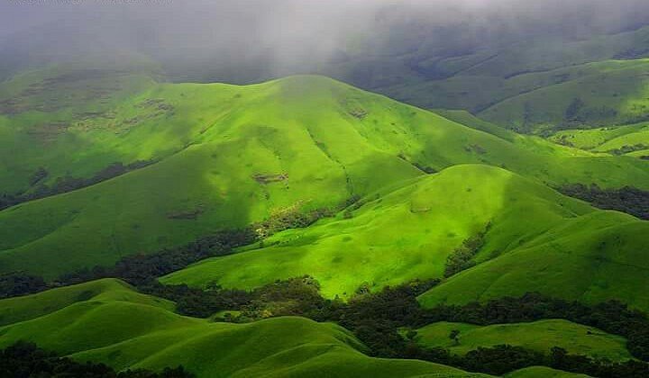
Mullayanagiri
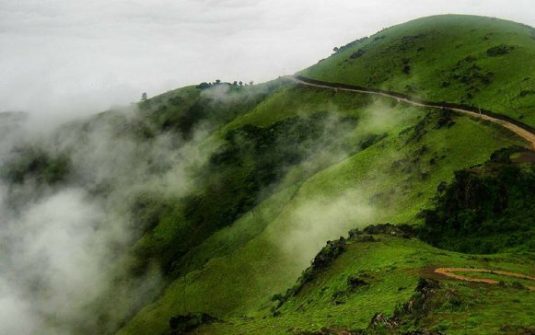
One of the most spectacular attractions in Chikmagalur is Mullayanagiri that is known for its jaw dropping natural beauty. With its calming ambience formed by lush greenery, misty weather and rugged rocks, Mullayanagiri is a heavenly place to relish your vacation. Mullayanagiri Peak is a heaven for adventure junkies who wish to partake in a number of thrilling activities like road biking, trekking and mountain biking.This place is also renowned for a small temple dedicated to Tapasvi Mullappa swamy and a trek to the peak takes one through many landmarks like some caves, a stream and a Nandi statue. Mullayanagari is one of the few places to visit in Chikmagalur where you will find yourself at loss of words as you behold the most majestic views of the landscape.
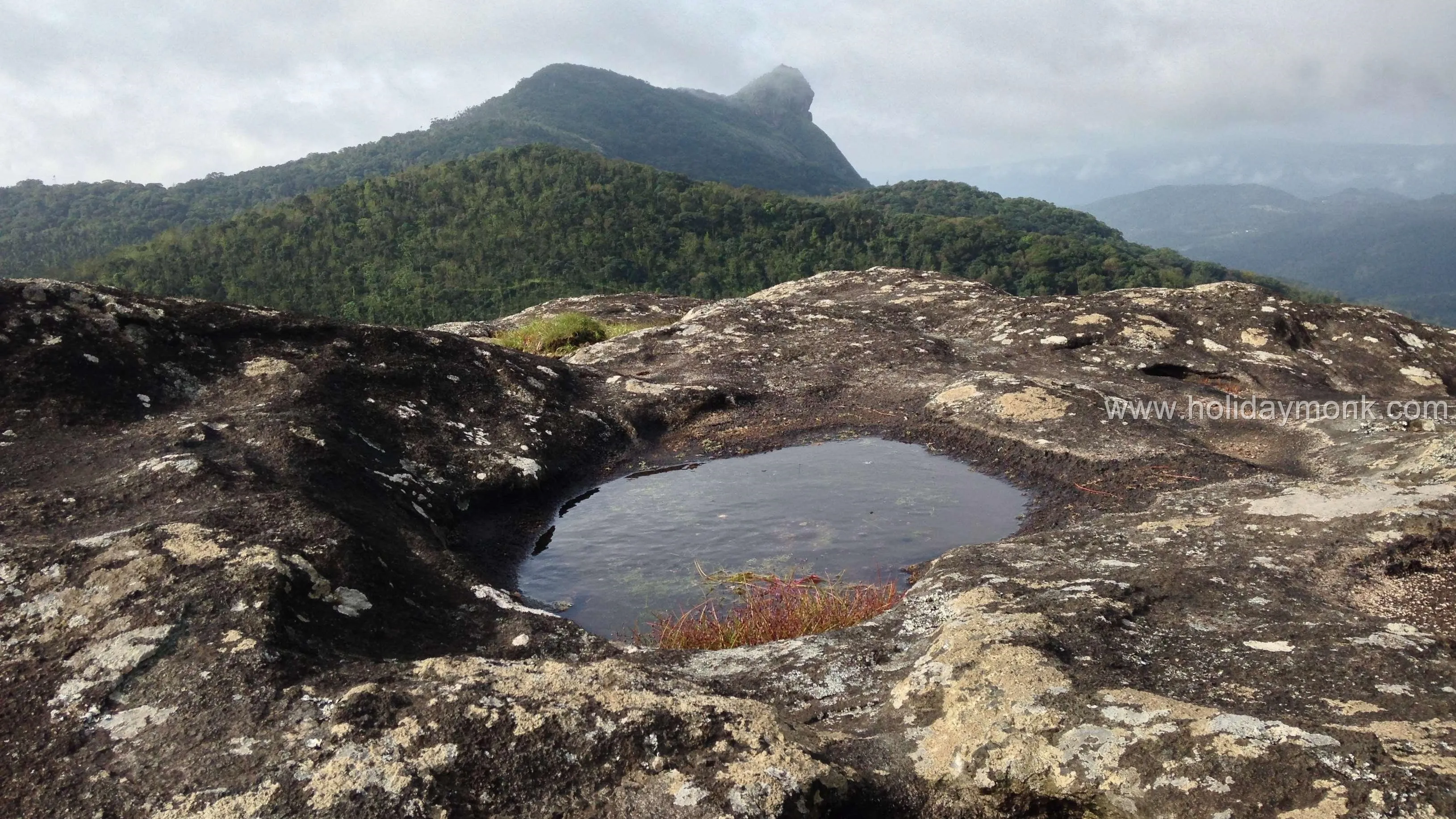
Seethalayyana giri
Seethalayanagiri is situated on the way to Mullayanagiri from Chikmagalur. The drive up the winding roads of Chandradrona hill on the way to Seethalayanagiri is very scenic. One can get some mesmerizing views from the top of the peak which is easily walkable from the parking area. Several visitors park their vehicles at Seethalayanagiri and trek to Mullayanagiri which is about 3 km from here.
Kavikal Gandi
Kavikal Gandi viewpoint is located at a distance of 11 kilometres from Baba Budangiri and, 18 kilometres from Chikmaglur, and at a distance of 11 kilometres from Malluayanagiri. This viewpoint is also known as the Horse Shoe Viewpoint. It is considered as a very popular viewpoint of Chikmaglur district of Karnataka state. The Kavikal Gandi Viewpoint is located within the route of Mullayanagiri to Baba Budangiri.
Hannamanahalla Falls
The Fall is located en route from Chickamagaluru to Dattapeeta and provides an opportunity to take a break from driving up. A long trail of falling water is visible above and below the road level and there is an opportunity for quickly taking a couple of pics. And if you are hungry, you can probably pick up a snack from the stalls next to the road. Good place to stop for a break!
Jhari Falls
Jhari Falls is a waterfall in Chikmagalur district in Karnataka state, India, near Mullayanagiri and Baba Budan Giri. Water originating in the mountains flows over steep rocks, in a wide and thin white layer. The waterfall is 267 km from Bengaluru and 24 km from Chikmagalur. Kadur Junction is the nearest railway station (57 km) and Mangaluru Airport is the nearest airport (180 kms). Taxis can be hired from Kadur or Chikmagalur, but the last five km to the falls are accessible only via jeep.
Dattatreya Peeta
The Inam Dattatreya Peeta is one of the significantly important places to visit in Chikmagalur and is a top religious centre in the country. Inam Dattatreya Peeta is also popularly known as Inam Dattapeeta, and in Chikmagalur tourism, the number of visitors in the place has always been high. The reason as to why this place is immensely significant as a sacred spot is that the Inam Dattatreya Peeta is a holy place for both Muslims and Hindus. Religious spots like with such religious harmony are rare to find in the country and hence are always included in any Chikmagalur tour package.
Deviramma temple
There are many incredible temples in India, and one such temple is the Deviramma temple located in the Chandra Drona hill ranges near the city of Chikmagalur in Karnataka. The temple nestles atop a 3,000 feet high hill named Deviramma hill and is open to devotees only on one day in the entire year. The temple opens on the Naraka Chaturdashi day, which marks the beginning of Diwali festival. The temple atop the hill is reached by 8-kilometre long trek. Lakhs of devotees await this auspicious day and start the trek early in the morning for the annual darshan of the Goddess.
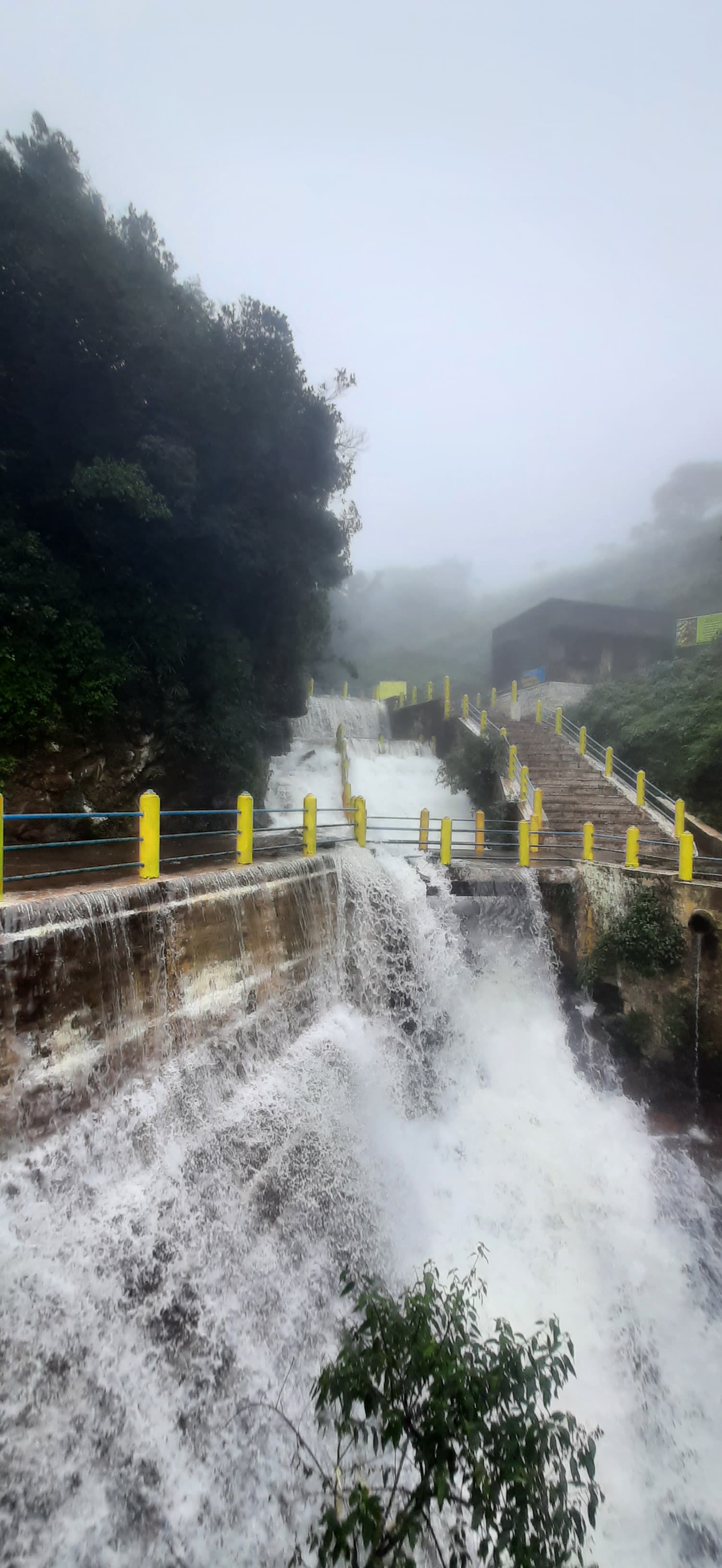
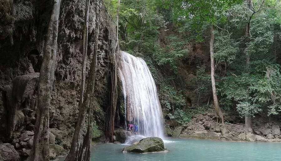
Kallathigiri Falls
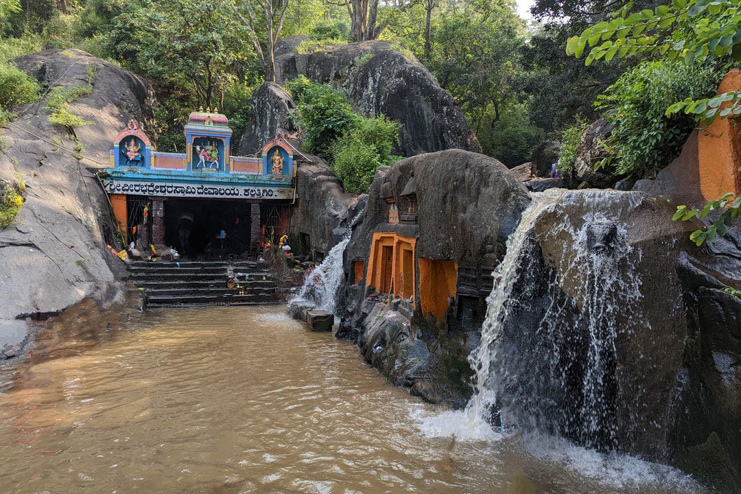
Kalhattigiri Falls is a waterfall on the headwaters of the river , located at Kallathigiri, Tarikere Taluk in Chikmagalur district of Karnataka. The waterfall is 10 kilometers (6.2 mi) away from Kemmangundi hill station.
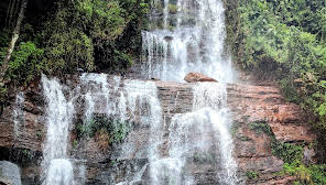
Hebbe Falls
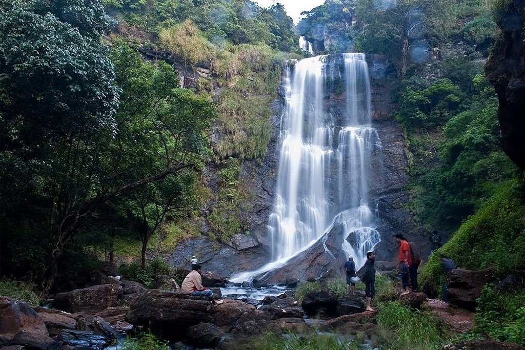
Hebbe Falls is situated about 10 km away from the famous hill station Kemmangundi. This waterfalls is inside a coffee estate and can be reached either by walk or four-wheeler. Hebbe Falls gushes down from a height of 551 ft in two stages to form Dodda Hebbe (Big Falls) and Chikka Hebbe (Small Falls.)
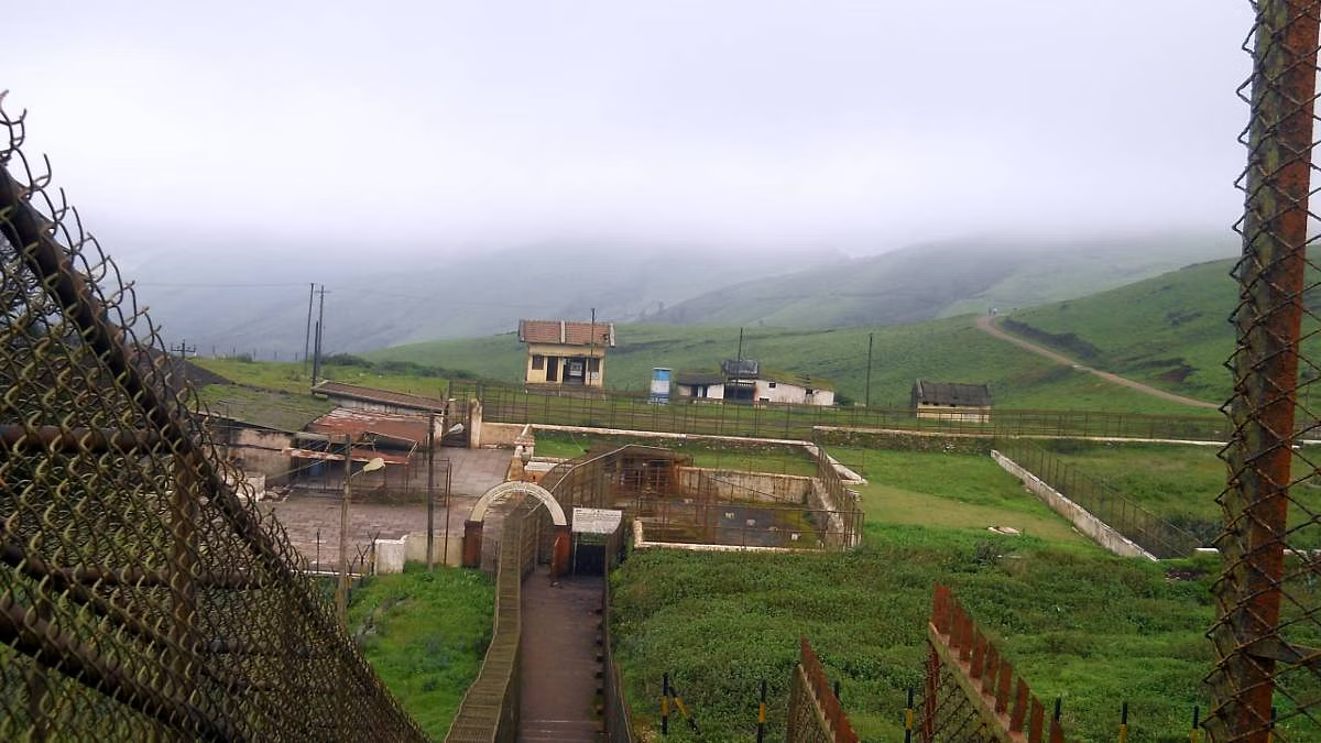
Kemmangundi
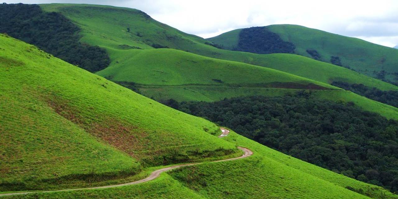
Kemmannugundi (Red Soil Pit) is a hill station in Tarikere taluk of Chikkamagaluru district in the state of Karnataka, India. It is at the elevation of 1434m above sea level, with its peak at 1863m. This was the summer retreat of Krishnaraja Wodeyar IV, and as a mark of respect to the king, it is also known as Sri Krishnarajendra Hill Station. The station is ringed by the Baba Budan Giri Range, with cascades, mountain streams, and lush vegetation. Kemmangundi has ornamental gardens and mountains and valleys views.
Z point
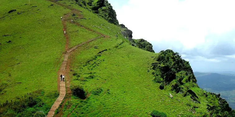
One must try the Z point trek while in Chikmagalur. Its 3.5km one way walk, the road starts through forest and opens up in grassland slopes. The trek is quite easy and most of the path is flat land. Towards the end we experienced wind velocity at almost 80kmph. Always struggle to reach the peak, as the views are mesmerizing.
Belavadi Temple
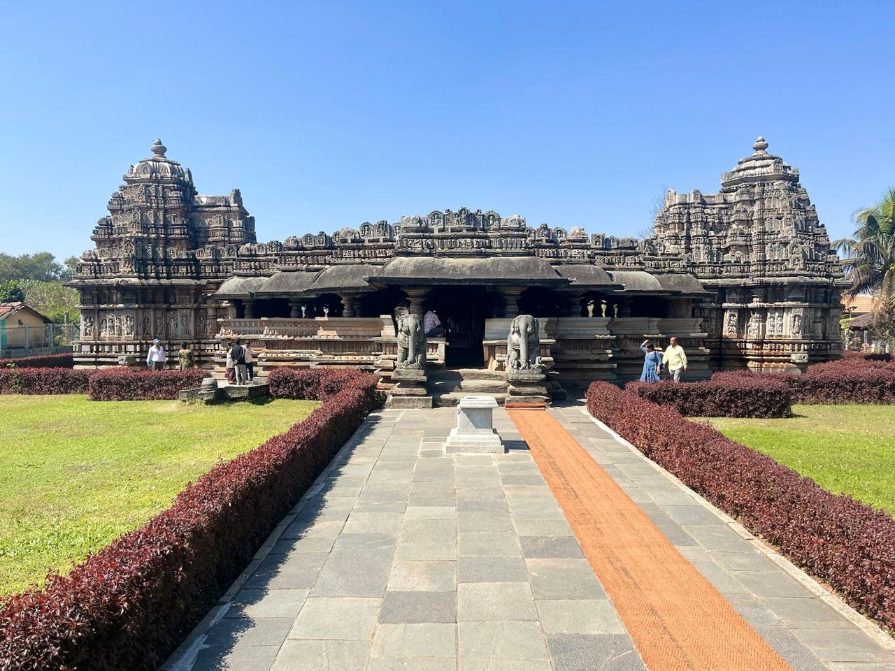
The Veera Narayana temple, also referred to as the Viranarayana temple of Belavadi, is a triple Hindu temple with a complex Hoysala architecture completed around 1200 CE. Close to Halebidu, this is a better preserved large Hoysala monument found in the small village of Belavadi, Chikkamagaluru district.
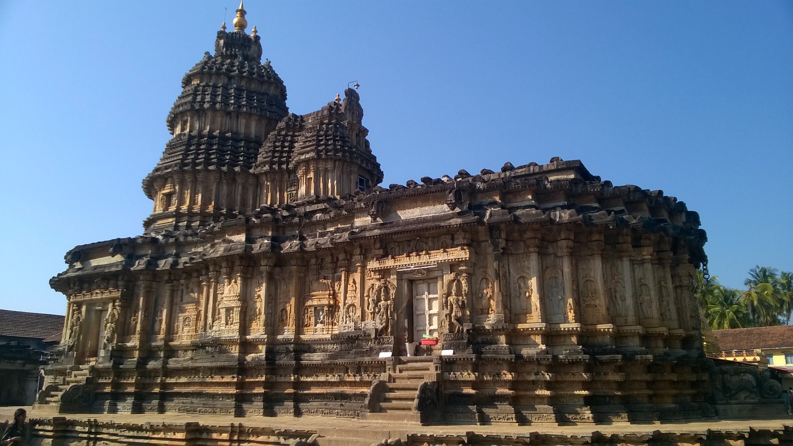
Hallebedu Temple
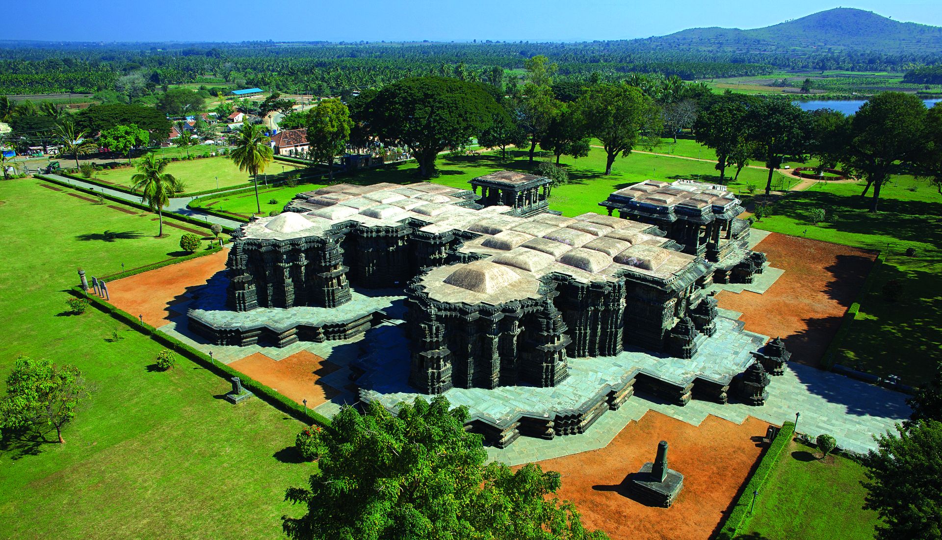
Hoysaleswara temple, also referred simply as the Halebidu temple, is a 12th-century Hindu temple dedicated to the god Shiva. It is the largest monument in Halebidu, a town in the state of Karnataka, India and the former capital of the Hoysala Empire. The temple was built on the banks of a large man-made lake, and sponsored by King Vishnuvardhana of the Hoysala Empire. Its construction started around 1121 CE and was complete in 1160 CE.
Yagachi Dam
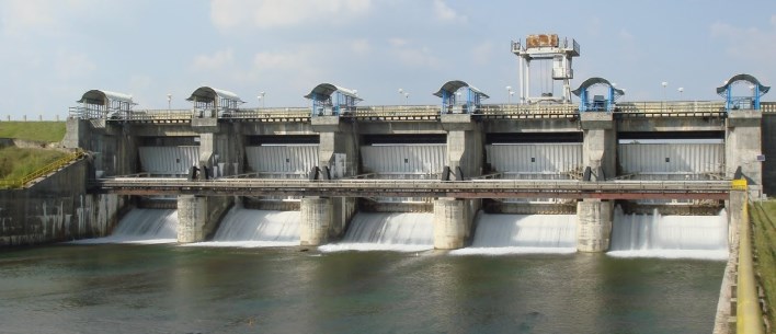
It's on the way to Chikmagalur, 3kM from Belur & just next to the road, worth a visit of max 10min. A relatively small dam that can be viewed from the side. A small garden & pathway is available for walking. Photo/Videography is allowed. Further 2kM down, 1KM from highway & drive on mud road, you will find the Yagachi Water sports facility on the backwaters of the same dam.
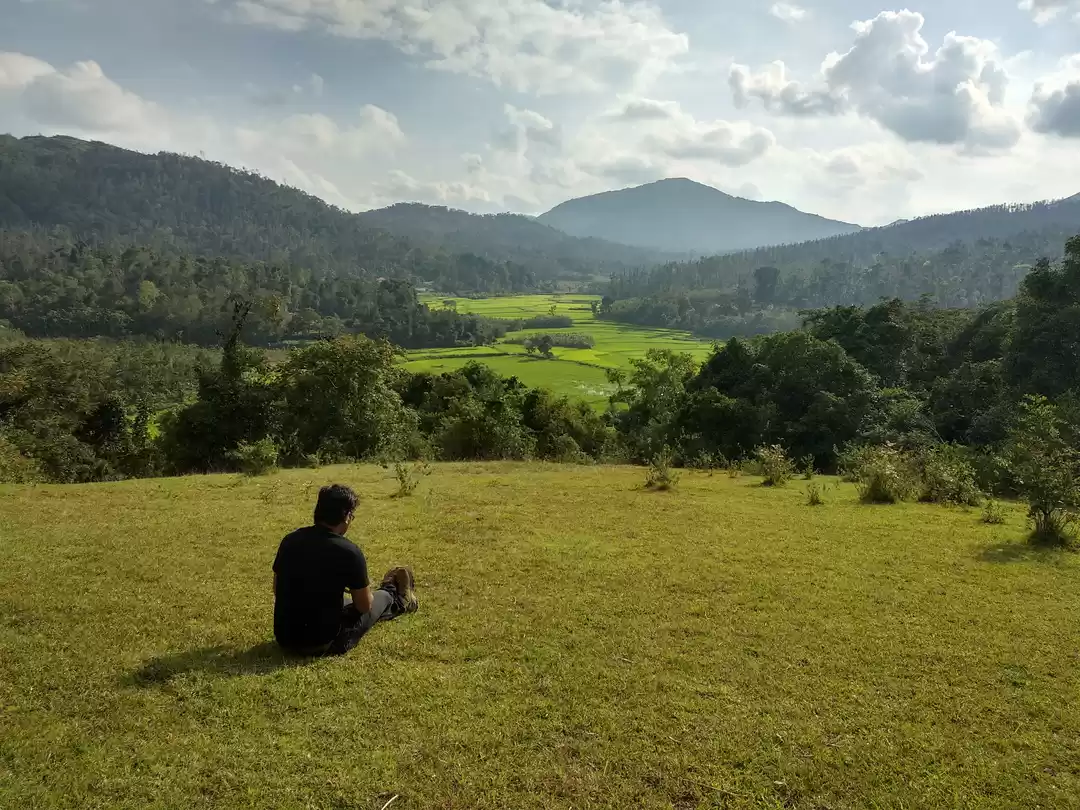
Hirekolale lake
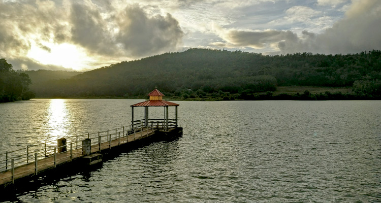
Amidst all the lush greenery and mountain ranges, a calm and serene lake called Hirekolale lake is present at the foothills of Mullayanagiri hills, another popular place to visit in Chikmagalur. The huge mountains of the western ghats surrounding the lake, further beautify the lake making it a favorite among nature lovers.
Bandekallu Gudda
Bandekallu Gudda is a spectacular hill station located in Mallanduru of Chikkamagaluru district. This hillock is very suitable for fully packed adventurous hiking. Since the road facility is good, you can also facilitate offroad biking. You can also take a jeep to climb the hill. After climbing the hill, you can see the fantabulous view of many hills like kemmangundi, Mullayanagiri, and forests. Bandekallu is only 14km from Rain tree stay.
Bhadra Tiger Safari
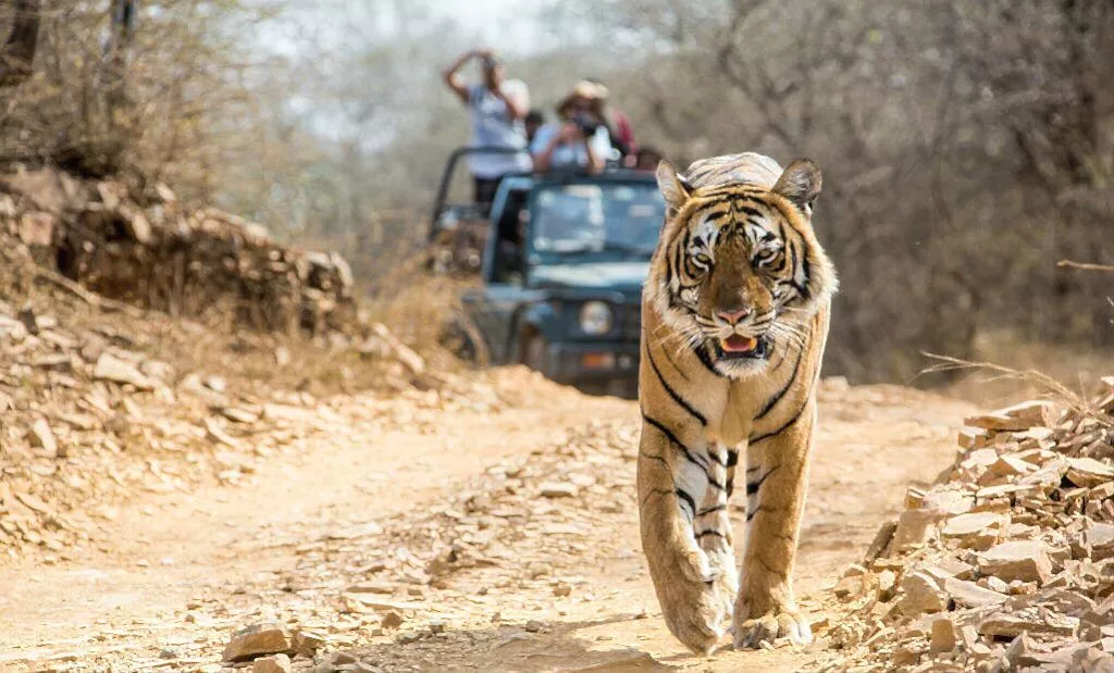
The sanctuary takes its name from the Bhadra River, its lifeline. Popularly known as Muthodi Wildlife Sanctuary, after the village on its periphery, it was declared a Project Tiger reserve. But apart from the tiger, it is a great place to sight and observe other mammals, reptiles, and more than 250 species of birds, many of which are endemic to the Western Ghats. The state-run Jungle Lodges & Resorts runs the River Tern Lodge located on a hillock on the edge of the Bhadra reservoir, near Lakkavali. It is a stone's throw away from the northern boundary of the Bhadra Tiger Reserve. Muthodi is the southern part of Bhadra Wildlife Sanctuary and is located in one of the most picturesque forest patches here. The sanctuary is also home to the Jagara Giant, the largest teak tree in the state which has a girth of 5.1 m with a height of 32 m and is said to be around 400 years old. Bhadra Tiger Reserve spans about 500 square km, spread across two districts Shivamogga and Chikmagalur districts.
Mallandur Shooting point
Mallanduru viewpoint also called as Mallanduru shooting point is just 2 km from the town. After the initial few meters of village ambiance, the route traverses through a small thick stretch of coffee estate and forest and it opens suddenly to the vast wide top of a small hillock. a narrow mud road takes you to the end of the open hill. This place makes you feel like you are in mid of some beautiful golf course with the spectacular view of paddy fields on one side and the hills covered by lush green forest on the other side.
Ukkada falls
Ukkada Falls are one of the lesser-known waterfalls in the Chikmagalur region that are safely tucked away in the lush green jungle area. Verdant green environments make up the majority of this location which is not only green but highly biodiverse as well, with many different species of animals, birds, and plants to explore and observe.
Rambhapuri Matta Balehonnur
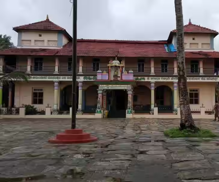
Rambhapuri Peetha is a heaven on earth, which is located on the banks of river Tunga and rich in its landscape, beauty with ever green flora and fauna. Its serenity and holistic spirit has made the people to pour in form all the parts of India , as also from rest of the world.
Sringeri Sharada temple Shankaracharya mutta
Sri Sringeri Mutt, as the Pitham is referred to in common parlance, is situated on the banks of the Tunga River in Sringeri. The Mutt complex consists of shrines on both the northern and southern banks of the river. The three prominent shrines on the northern bank of the Tunga are dedicated to the presiding deity of the Pitham and the divinity of Atma-vidya - Sri Sarada, Sri Adi Sankara, and Jagadguru Srī Vidyasankara Tīrtha, the 10th Jagadguru of the Pitham. The southern bank houses the residence of the reigning pontiff, the adhisthanam shrines of the previous pontiffs and the Sadvidya Sanjivini Samskrita Mahapathashala.
Kudremukh
Kudremukha is the name of a mountain range and an individual mountain peak located in Chikmagalur district, in Karnataka, India. It is also the name of a small hill station and iron ore-mining town situated near the mountain, about 20 kilometres from Kalasa in Kalasa Taluk. The name Kuduremukha literally means "horse-faced" in Kannada and refers to a particular picturesque view of a side of the mountain that resembles a horse's face. It was also referred to as 'Samseparvata', historically since it was approached from Samse village. Kuduremukha is Karnataka's 2nd highest peak after Mullayanagiri and 26th highest peak in western ghats. The nearest International Airport is at Mangalore which is at a distance of 99 kilometres.
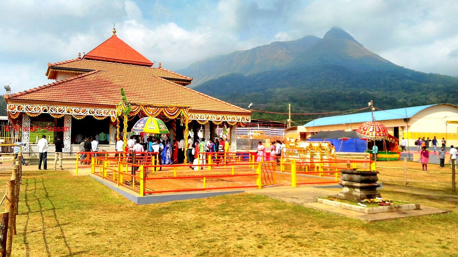
Kalaseshwara temple kalasa
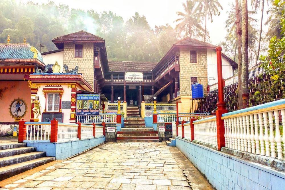
Nestled in the picturesque town of Chikkamagalur in the lap of nature, Kalasa temple is located on the banks of River Bhadra. Believed to have been built by Sage Agasthya, the Kalasa temple has many other small temples and sacred water bodies that add value to its serenity.As per the researchers, the temple has a few inscriptions from 1154 CE. It is believed that the sanctum was built by Vidarbha king Shruth Bindu and later in the 16th century was modified by Keladi and Karkala Nayakas and kings. Much later Maharaja of Mysore contributed to the intricate silver door and the golden crown was offered by Somashekhar Nayaka.
Horanadu annapoorneshwari temple
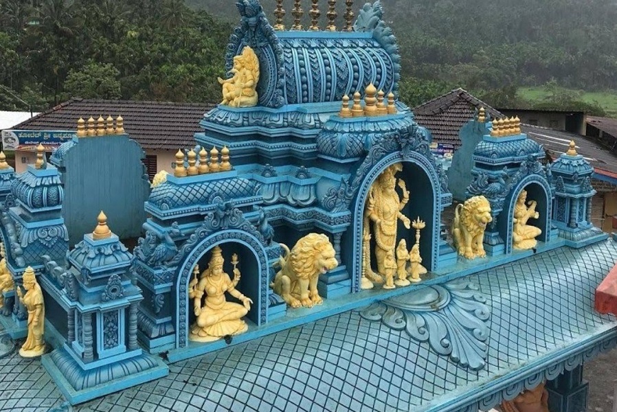
Located in midst of picturesque lush green landscapes of the Western Ghats, just 10 km away from Kalasa is the divine temple of Sri Annapoorneshwari at an elevation of 831 m or approximately 2726 ft. Horanadu is a small panchayat village in the Chikkamagalur district in Kalasa taluk and is visited by pilgrims throughout the year.